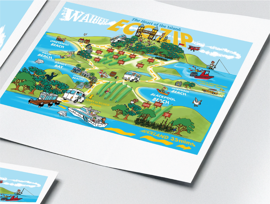
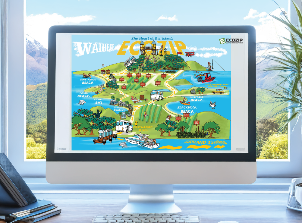
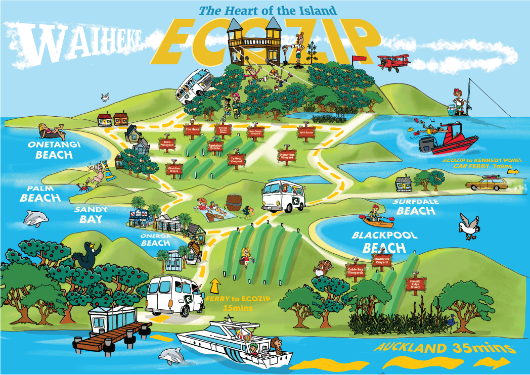
The Brief: Create a bright illustrated map of Waiheke Island to help guests: Travel from the ferry terminal to EcoZip, understand where they are, discover local attractions and wineries, and feel excited before they even arrive. The style had to be playful, welcoming, and easy to read. The Challenge: Waiheke isn’t flat. It’s layered, hilly, and irregular. Turning real geography into something accurate and fun was the real design challenge. I had to: Simplify the island’s scale and proportions, shift perspective into a low 3D view, keep landmarks recognisable, make navigation clear without losing charm, and it needed to work as both a practical guide and a piece of art. The Idea: I created a cartoon-style, low 3D perspective looking from the ferry terminal up toward EcoZip on the hill. The map includes: Illustrated wineries and local attractions, small characters throughout the landscape, town markers and environmental details, a clear visual journey from sea level to treetop zipline. The result feels alive — not flat. What I Delivered: Fully illustrated custom map, character illustrations, custom icons and landmarks, print-ready artwork, digital-ready version for web use.